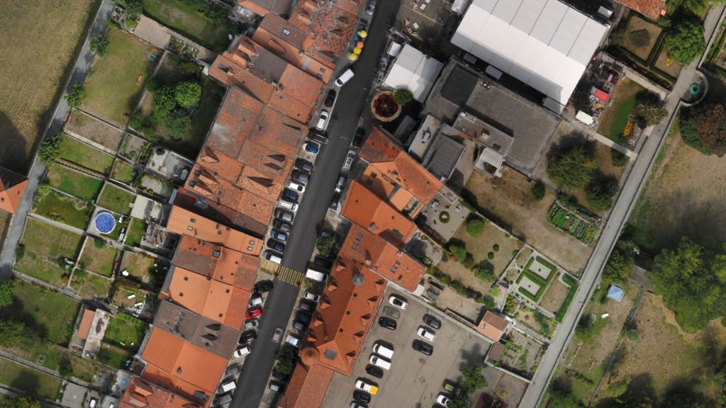
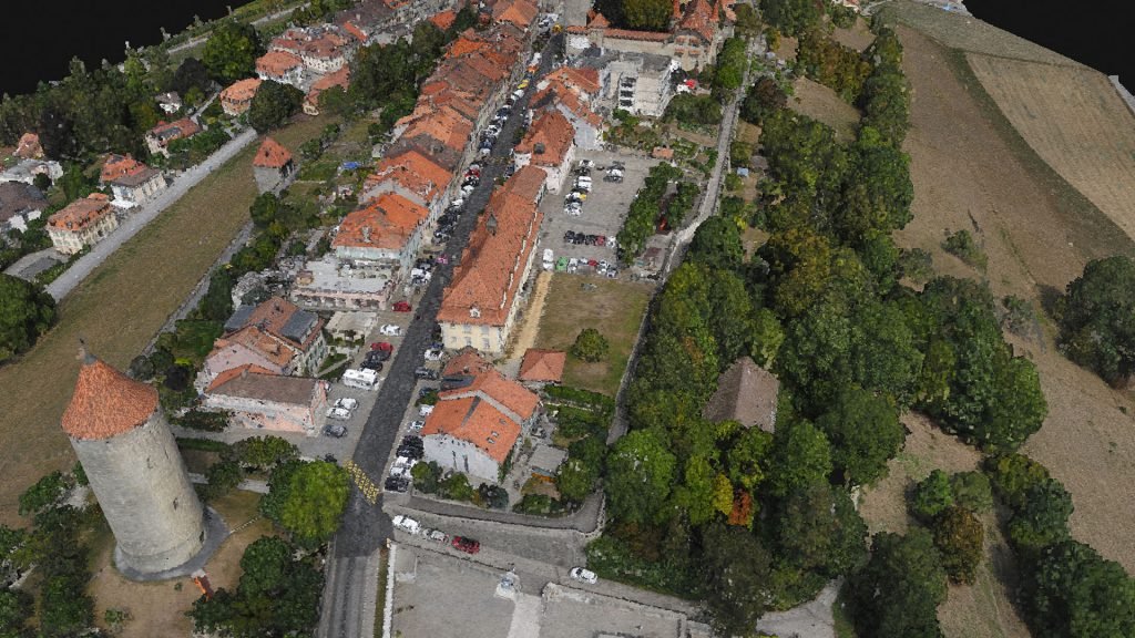
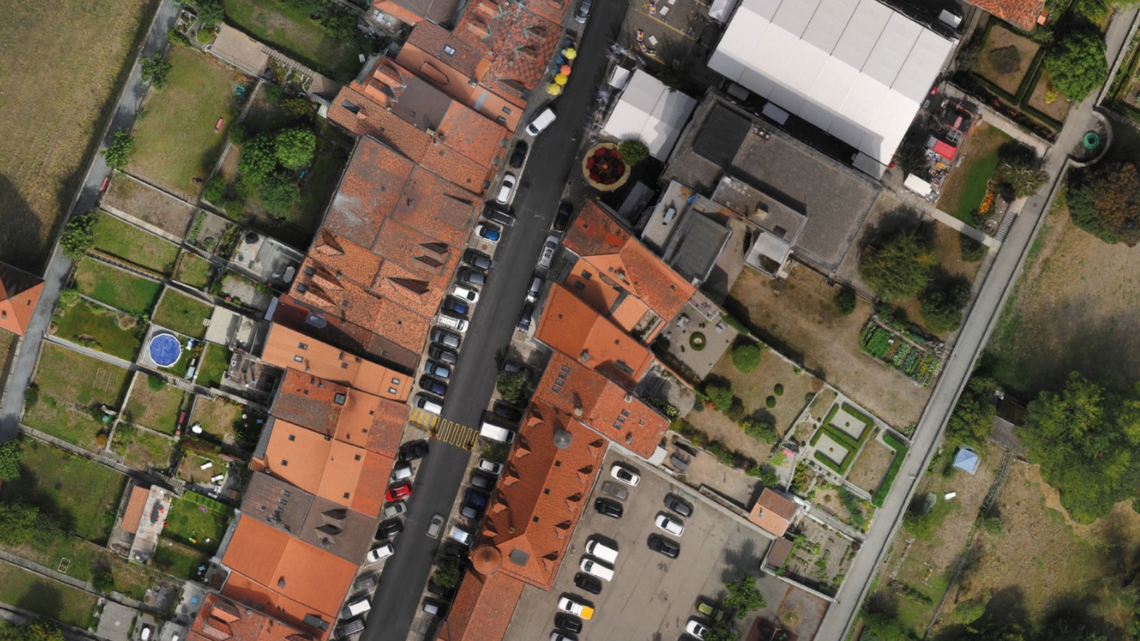
 An orthophoto, orthophotograph or orthoimage is an aerial photograph ge-ometrically corrected (“orthorectified”) such that the scale is uniform: the photo has the same lack of distortion as a map. Unlike an uncorrected aerial photo-graph, an orthophotograph can be used to measure true distances, because it is an accurate representation of the earth’s surface, having been adjusted for topographic relief, lens distortion, and camera tilt.
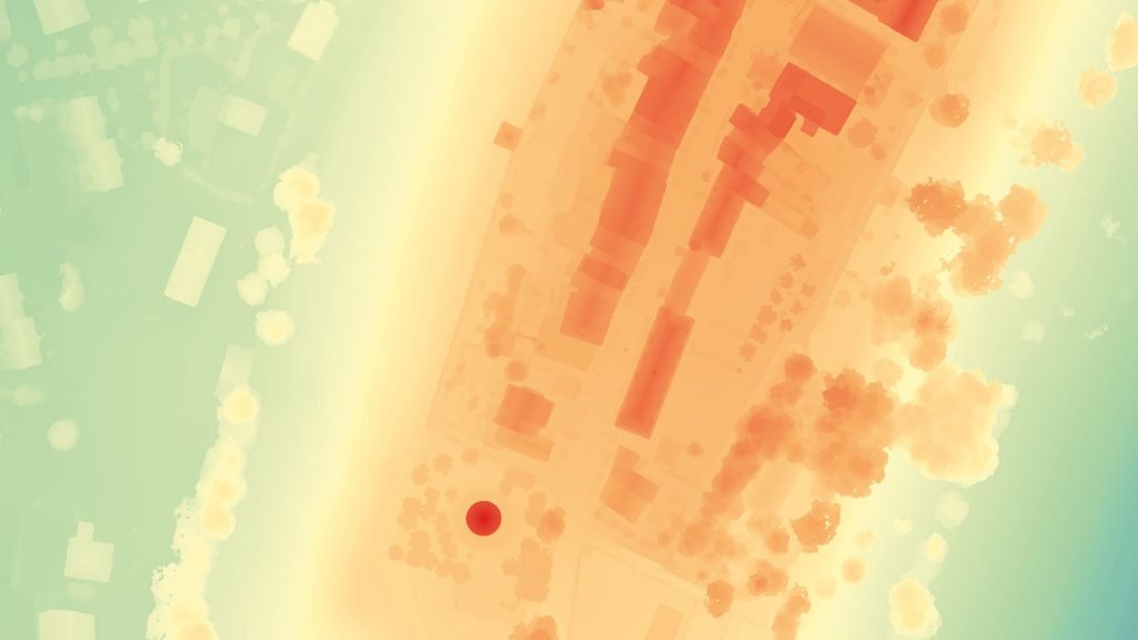
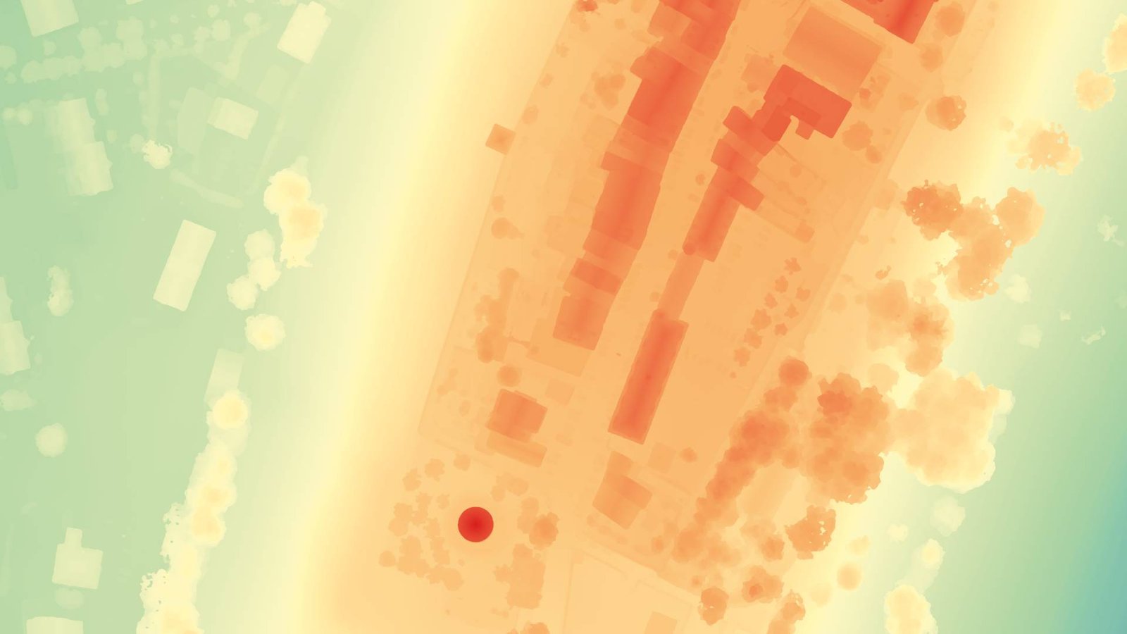 Digital Terrain Models (DTM) sometimes called Digital Elevation Models (DEM) is a topographic model of the bare Earth that can be manipulated by computer programs.The data files contain the elevation data of the terrain in a digital for-mat which relates to a rectangular grid. Vegetation, buildings and other cultural features are removed digitally – leaving just the underlying terrain.DTMs are used especially in civil engineering, geodesy & surveying, geophysics, geog-raphy and remote sensing.
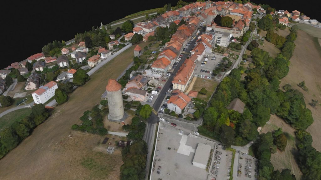
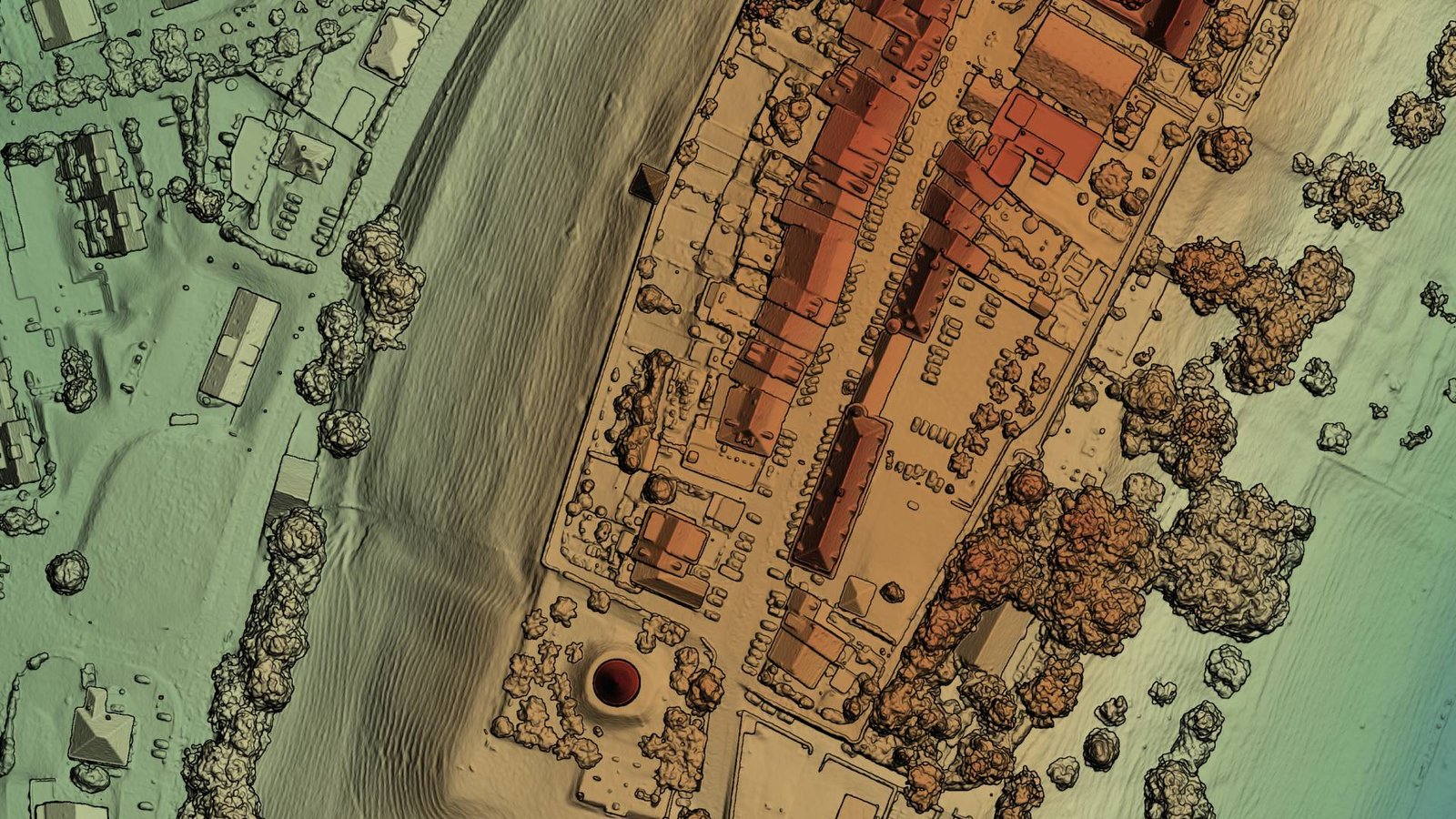 Digital Surface Model (DSM) that includes ground surface, vegetation and man-made objects. DSM demonstrate the natural and artificial features on the Earth’s surface. Digital Surface Model may be useful for RF planning, land-scape modelling, city modelling, visualization applications and more.
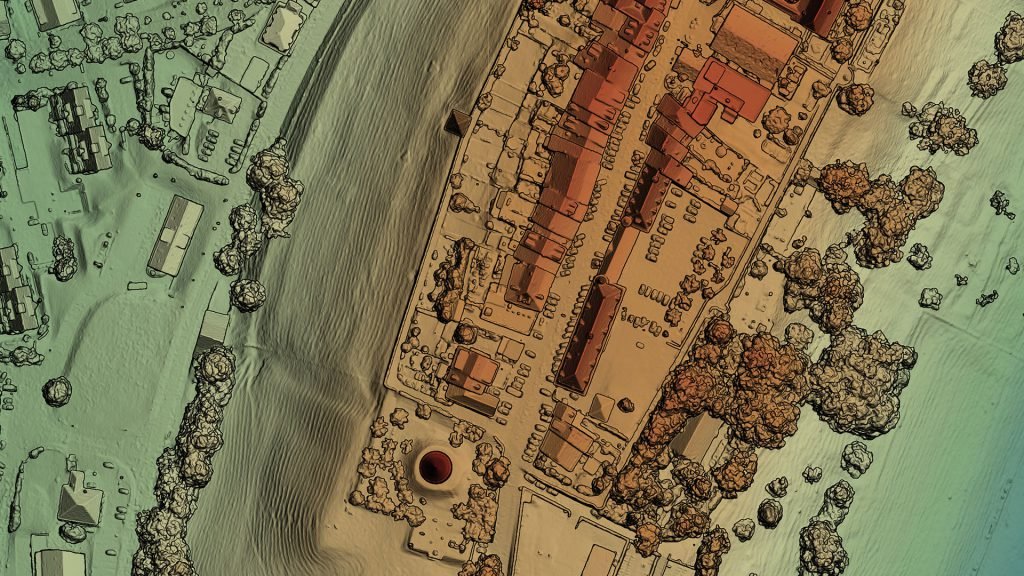
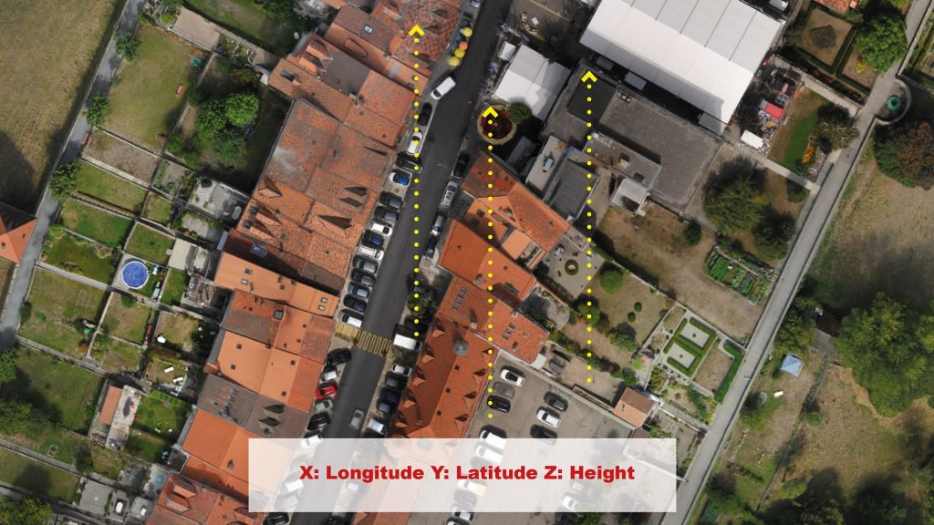
 A point cloud is a set of data points in space. The points represent a 3D shape or object. Each point has its set of X, Y and Z coordinates. Point clouds are generally produced by photogrammetry software, which measure many points on the external surfaces of objects around them. As the output of 3D scanning processes, point clouds has many applications.
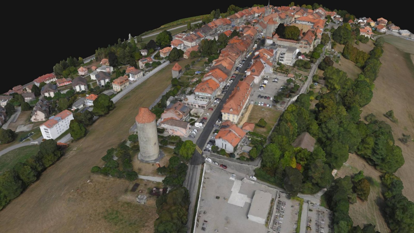 A 3D mesh is the structural build of a 3D model consisting of polygons. 3D meshes use reference points in X, Y and Z axes to define shapes with height, width and depth.
While it can take large numbers of polygons to make a 3D mesh approach photorealism, these relatively simple shapes allow for faster processing than other techniques, like NURBS, that produce smooth curves. The polygons used are typically quadrangles or triangles; these geometric shapes can be further broken down into vertices in X, Y, Z coordinates and lines.
A 3D mesh is the structural build of a 3D model consisting of polygons. 3D meshes use reference points in X, Y and Z axes to define shapes with height, width and depth.
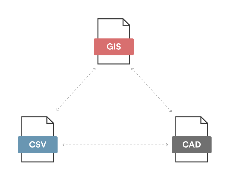
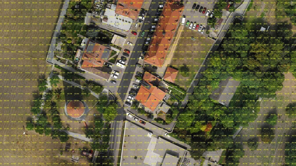
While it can take large numbers of polygons to make a 3D mesh approach photorealism, these relatively simple shapes allow for faster processing than other techniques, like NURBS, that produce smooth curves. The polygons used are typically quadrangles or triangles; these geometric shapes can be further broken down into vertices in X, Y, Z coordinates and lines.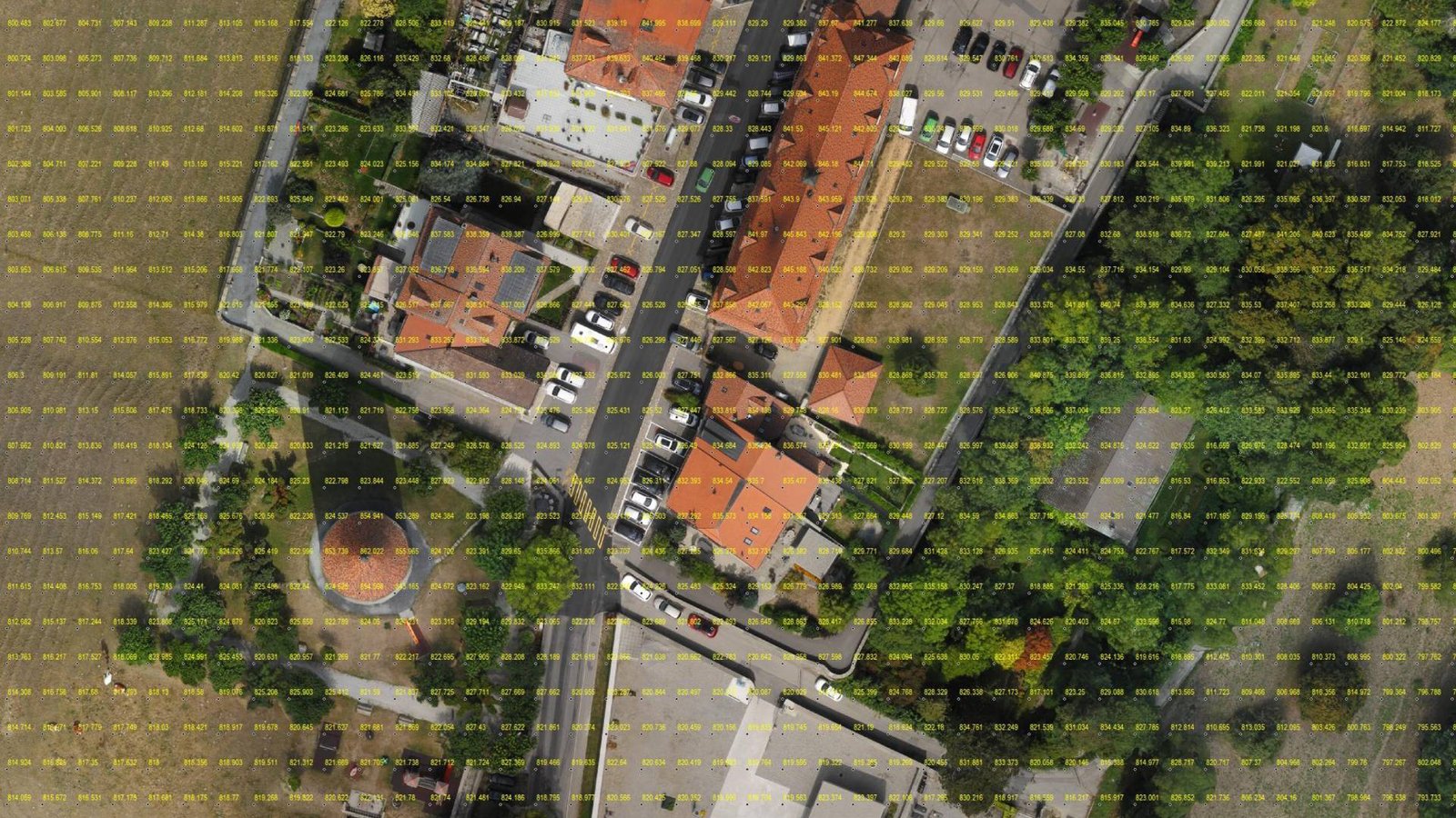 The Grid Points are simply the conversion of the Digital Elevation Model (DEM) either DTM or DSM at certain equal intervals. This data is particularly helpful in interoperability between different working software environments.
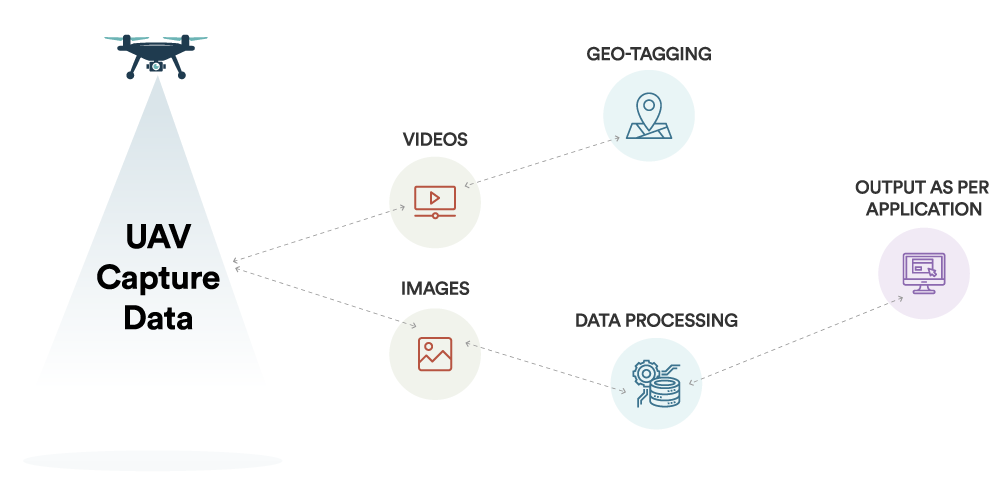
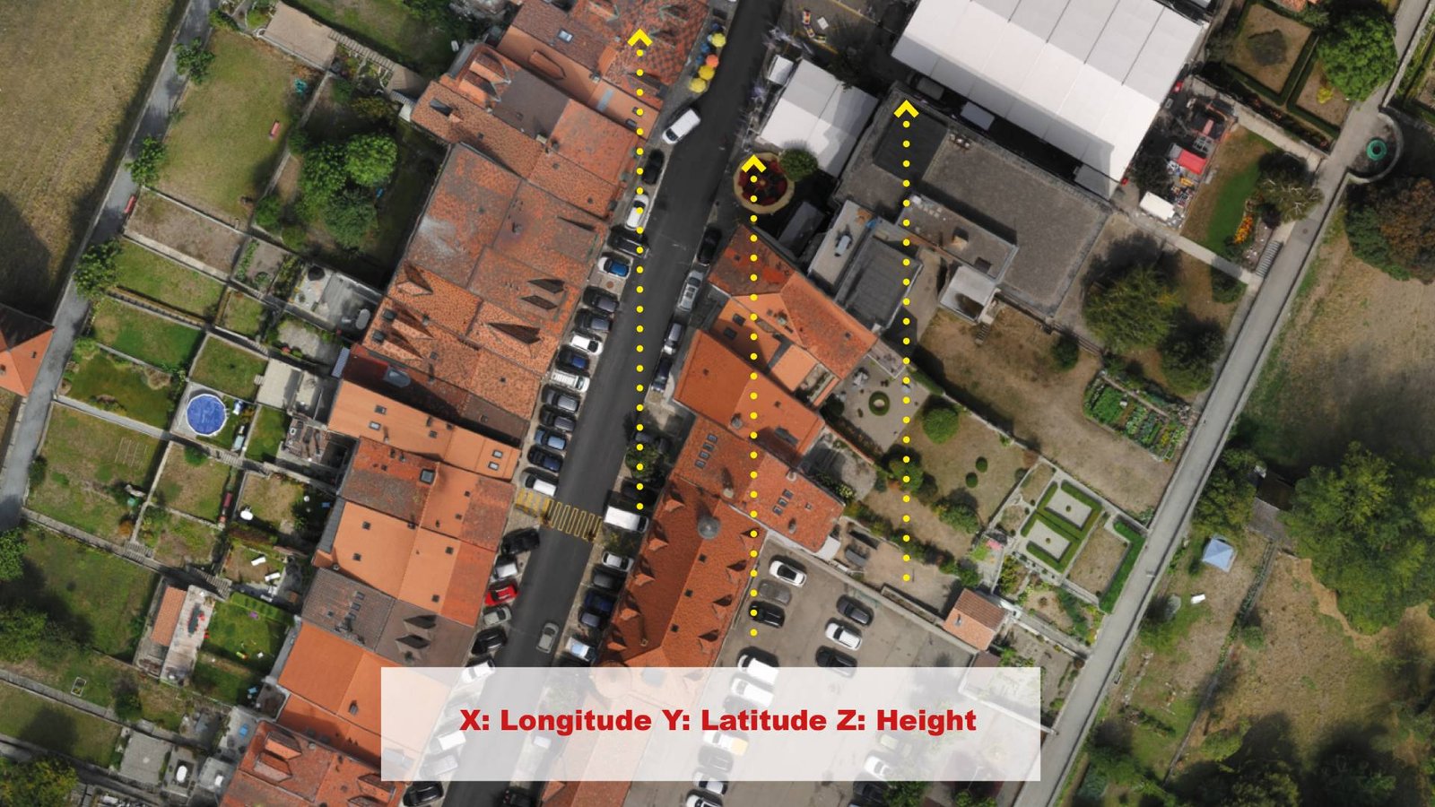 Geotagging, or GeoTagging, is the process of adding geographical identifi-cation metadata to various media such as a geotagged photograph or video. Two main options can be used to geotag photos: capturing GPS information at the time the video is taken or “attaching” geocoordinates to the video after the picture is taken.